Project planning & design
As part of the infrastructure upgrade designs for Auricchio Avenue and Norman Street, St Marys, the City of Mitcham identified the opportunity to divert and treat stormwater run off from Aurrichio Avenue into Norman Street Reserve at a number of locations, and to use this stormwater to passively irrigate trees and the grassed basin both within the Norman Street Reserve and in areas surrounding St Marys Oval.
The implementation of WSUD features as a means of reducing stormwater runoff and increasing alternative water use is a key objective of the City of Mitcham’s Strategic Management Plan and is also consistent with climate change adaptation plans adopted under the Resilient South Project, the Health and Wellbeing Plan, and in line with “green infrastructure” principles.
WSUD features
The project showcases several types of WSUD including permeable paving, sediment basins, raingardens, swales and infiltration (soakage) trenches.
Previously, stormwater in the street was managed via the kerb and gutter system draining to a conventional underground stormwater pipe system and associated side entry pits (SEPs) at the end of the street. In the new design, runoff from Aurrichio Avenue and Norman Street is directed to a series of three raingardens and an infiltration basin that are located and sized to cater to the contributing sub-catchment. The raingardens contain sedges and rushes that are effective at removing pollutants, in particular nitrogen, from the stormwater.
Treated stormwater filtered by the infiltration basins to the south of the site overflows to the raingardens to the north via a series of swales and distributes this filtered water throughout the reserve. During high rainfall events, additional water is diverted to nearby infiltration (soakage) trenches. Any subsequent overflow from this series of WSUD features discharges to the existing downstream drainage system and ultimately to the Patawalonga.
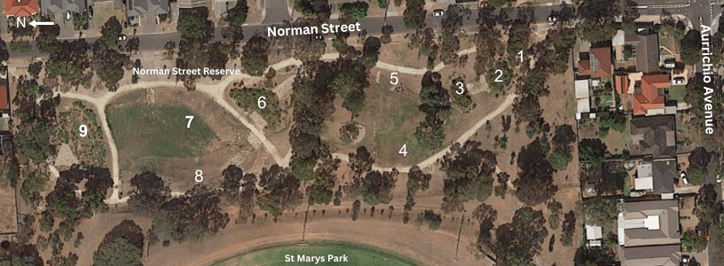
The WSUD stormwater treatment train includes (from upstream at the south of the site):
Norman Street Reserve, St Marys – locality map showing the stages of the treatment train
1. rock-lined swale
2. 1 metre deep infiltration system below 50mm deep vegetated storage basin
3. a 2nd, 1 metre deep infiltration system below 50mm deep vegetated storage basin
Outflows from the infiltration basins (2 and 3) are then split between:
4. infiltration trenches
5. swales
Flows from the swales and local street runoff discharge into:
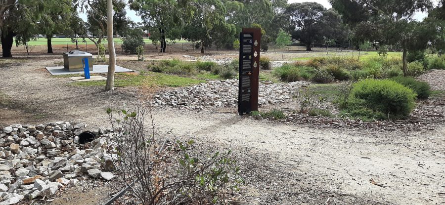
6. bioretention basin with 200mm extended detention (refer to main photo)
The overflow from the bioretention basin (6) is split via a rock weir supplying both:
7. large 50mm deep retention basin combined with infiltration trenches, which is also suitable for recreational use
8. rock-lined swale
Both of the above WSUD assets (7 and 8) overflow to:
9. bioretention basin with 100mm extended detention deep which also receives direct local street runoff.
Any excess flows from the system discharge to downstream creeks and drainage networks via the north western corner of the site
Back

